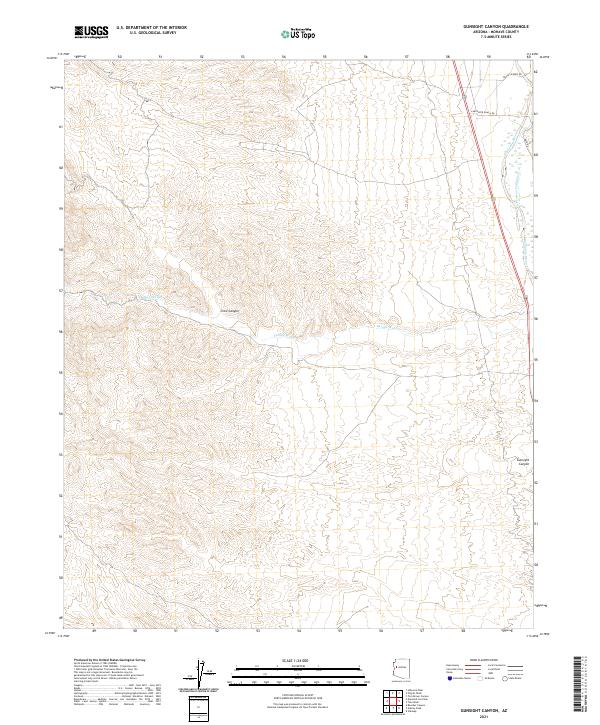
2021 Map of Gunsight Canyon
USGS Topo · Published 2021About this map
Big Sandy River defines the eastern edge of this arid Mohave County landscape, where deep drainage systems like Deluge Wash and Pearson Falls Wash cut through the high terrain. The map captures a transition between the river corridor and the elevated interior of the Hualapai Mountains foothills, centered on significant geological breaks like Crow Canyon and Gunsight Canyon. Modern land use is indicated by ranching access routes including Bogie's Ranch Rd and Carpenter Ranch Rd, which parallel the river valley. This 2021 survey provides a contemporary view of the region's topography, illustrating how the natural watercourses and canyons continue to dictate the placement of local roads like Back Rd and the division of public lands within the township and range system.
Find a feature on this map
14 named features on this map. Tap any name to fly to it.
Don’t see what you’re looking for? This feature index may not catch every label — zoom into the map to look around manually.
Map Details
Editions of this 2021 Gunsight Canyon Map
This is the sole edition of this map. No revisions or reprints were ever made.
Other maps of this area

1923 · Signal
USGS Topo · 1:250,000

1942 · Signal
USGS Topo · 1:250,000

1950 · Prescott
USGS Topo · 1:250,000

1954 · Prescott
USGS Topo · 1:250,000

1958 · Prescott
USGS Topo · 1:250,000

1959 · Prescott
USGS Topo · 1:250,000

1960 · Prescott
USGS Topo · 1:250,000

1965 · Prescott
USGS Topo · 1:250,000
1967 · Gunsight Canyon
USGS Topo · 1:24,000
1967 · Beecher Canyon
USGS Topo · 1:24,000