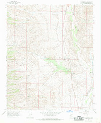
1967 Map of Gunsight Canyon
USGS Topo · Published 1969About this map
The Big Sandy River defines the eastern edge of this Mohave County landscape, where the high desert terrain breaks into a network of steep canyons and washes. Surveyed in the late 1960s, the map reveals a remote environment focused on livestock and water management, evidenced by features like the Corral, scattered Water Tanks, and a lone Spring. The topography is dominated by the prominent Gunsight formation, which feeds the drainage systems of Gunsight Canyon and Tompkins Canyon as they flow toward the river valley. Human activity is sparse and functional, primarily marked by a network of Jeep Trails and a single Prospect located near Deluge Wash. This sheet provides a detailed look at the hydrology of the eastern Big Sandy valley before modern developments, showing how land use followed the natural contours of the desert washes.
Find a feature on this map
16 named features on this map. Tap any name to fly to it.
Don’t see what you’re looking for? This feature index may not catch every label — zoom into the map to look around manually.
Map Details
Editions of this 1967 Gunsight Canyon Map
2 editions found
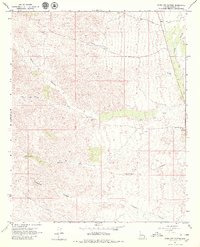
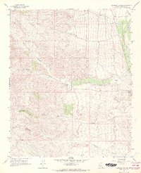
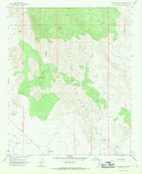
Other maps of this area

1923 · Signal
USGS Topo · 1:250,000

1942 · Signal
USGS Topo · 1:250,000

1950 · Prescott
USGS Topo · 1:250,000

1954 · Prescott
USGS Topo · 1:250,000

1958 · Prescott
USGS Topo · 1:250,000

1959 · Prescott
USGS Topo · 1:250,000

1960 · Prescott
USGS Topo · 1:250,000

1965 · Prescott
USGS Topo · 1:250,000
1967 · Beecher Canyon
USGS Topo · 1:24,000
1967 · Pilgrim Wash
USGS Topo · 1:24,000