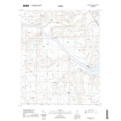
2020 Map of Guntersville Dam
USGS Topo · Published 2020About this map
Guntersville Dam anchors the landscape where the Tennessee River broadens into Wheeler Lake and Guntersville Lake. This riverine environment is defined by dramatic river bluffs such as Painted Bluff, Blue Rock Bluff, and Clark Bluff, which overlook the winding course of the Paint Rock River. The interior terrain is a complex of named hollows and ridges, including Vaughn Hollow and Russell Ridge.
Find a feature on this map
129 named features on this map. Tap any name to fly to it.
Don’t see what you’re looking for? This feature index may not catch every label — zoom into the map to look around manually.
Map Details
Editions of this 2020 Guntersville Dam Map
This is the sole edition of this map. No revisions or reprints were ever made.
Other maps of this area

1885 · Gadsden
USGS Topo · 1:125,000

1888 · Cullman
USGS Topo · 1:125,000

1888 · Gadsden
USGS Topo · 1:125,000

1888 · Scottsboro
USGS Topo · 1:125,000

1888 · Huntsville
USGS Topo · 1:125,000

1892 · Cullman
USGS Topo · 1:125,000

1892 · Huntsville
USGS Topo · 1:125,000

1892 · Scottsboro
USGS Topo · 1:125,000

1892 · Gadsden
USGS Topo · 1:125,000

1895 · Gadsden
USGS Topo · 1:125,000