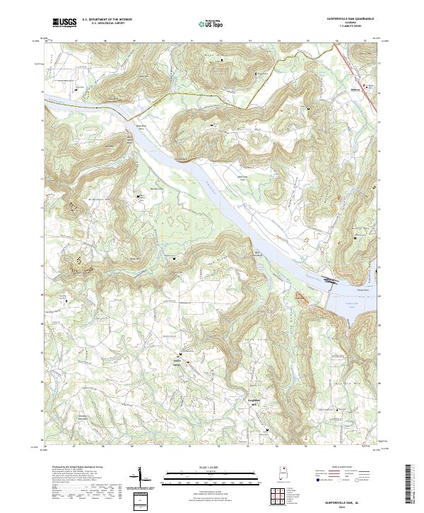
2024 Map of Guntersville Dam
USGS Topo · Published 2024About this map
The Tennessee River carves a sweeping path through Marshall County, where it meets the waters of the Paint Rock River and Little Paint Rock Creek. This landscape is defined by the transition from the river valley to prominent heights like Georgia Mtn and Brindley Mountain. Historically, river crossings were essential for regional connectivity, evidenced by the sites of Bean Rock Ferry and Honey Ferry. The topography is particularly distinct near Cotton Sinks, where the terrain reflects the complex drainage of the area south of the river.
Find a feature on this map
137 named features on this map. Tap any name to fly to it.
Don’t see what you’re looking for? This feature index may not catch every label — zoom into the map to look around manually.
Map Details
Editions of this 2024 Guntersville Dam Map
This is the sole edition of this map. No revisions or reprints were ever made.
Other maps of this area

1885 · Gadsden
USGS Topo · 1:125,000

1888 · Cullman
USGS Topo · 1:125,000

1888 · Gadsden
USGS Topo · 1:125,000

1888 · Scottsboro
USGS Topo · 1:125,000

1888 · Huntsville
USGS Topo · 1:125,000

1892 · Cullman
USGS Topo · 1:125,000

1892 · Huntsville
USGS Topo · 1:125,000

1892 · Scottsboro
USGS Topo · 1:125,000

1892 · Gadsden
USGS Topo · 1:125,000

1895 · Gadsden
USGS Topo · 1:125,000