
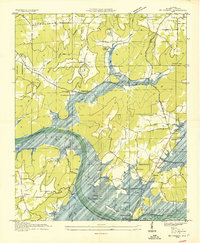
1936 Map of Guntersville
USGS Topo · Published 1936About this map
Guntersville sits at a critical bend of the Tennessee River in this 1936 survey, showing the landscape just as the Guntersville Reservoir was taking shape. The engineering of the Tennessee Valley Authority is evident in the transition from riverine commerce to hydroelectric development, marked by the George S Houston Toll Bridge and the N C & St L RR Gunters Landing Ferry Term. Away from the water, the map reveals a dense network of rural community life across Sand Mountain and the Spring Valley. Small, isolated settlements like Warrenton and Wyeth City are documented alongside numerous country anchors such as Pleasant Grove Sch, Mt Olive Ch, and Mahans Store, providing a detailed record of Marshall County's social geography before mid-century modernization altered these upland and valley communities.
Find a feature on this map
77 named features on this map. Tap any name to fly to it.
Don’t see what you’re looking for? This feature index may not catch every label — zoom into the map to look around manually.
Map Details
Editions of this 1936 Guntersville Map
This is the sole edition of this map. No revisions or reprints were ever made.
Other maps of this area

1885 · Gadsden
USGS Topo · 1:125,000

1888 · Gadsden
USGS Topo · 1:125,000

1892 · Gadsden
USGS Topo · 1:125,000

1895 · Gadsden
USGS Topo · 1:125,000

1903 · Gadsden
USGS Topo · 1:125,000

1936 · Mountainboro
USGS Topo · 1:24,000

1936 · Columbus City
USGS Topo · 1:24,000

1936 · Guntersville Dam
USGS Topo · 1:24,000

1936 · Arab
USGS Topo · 1:24,000
1936 · Mt Carmel
USGS Topo · 1:24,000