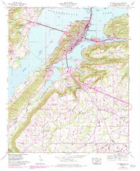
1948 Map of Guntersville
USGS Topo · Published 1983About this map
The town of Guntersville sits prominently along the southern banks of Guntersville Lake, where the landscape is defined by the significant rise of Negro Mountain and Sand Mountain. This 1948 survey, updated with 1980s data, reveals a community shaped by both modern water management and much older historical markers, such as the Old Cherokee Boundary running through the western hills. The peninsula shows dense development in Southtown and Mill Village, while the surrounding terrain is etched with numerous hollows like Davidson Hollow and Lindsey Hollow. Along the southern reaches, the Tennessee Valley Divide marks the watershed boundary, dotted with family-named landmarks and rural congregations like Bond Chapel and Mt Olive Ch. The infrastructure reflects the area's mid-century growth, featuring the Lurleen Wallace Memorial Pkwy and the Seaboard System railroad tracks winding through the valley.
Find a feature on this map
83 named features on this map. Tap any name to fly to it.
Don’t see what you’re looking for? This feature index may not catch every label — zoom into the map to look around manually.
Map Details
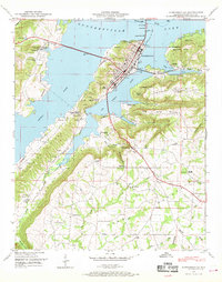
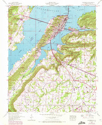
Editions of this 1948 Guntersville Map
3 editions found
Other maps of this area

1885 · Gadsden
USGS Topo · 1:125,000

1888 · Gadsden
USGS Topo · 1:125,000

1892 · Gadsden
USGS Topo · 1:125,000

1895 · Gadsden
USGS Topo · 1:125,000

1903 · Gadsden
USGS Topo · 1:125,000

1936 · Guntersville
USGS Topo · 1:24,000

1936 · Mountainboro
USGS Topo · 1:24,000

1936 · Columbus City
USGS Topo · 1:24,000

1936 · Guntersville Dam
USGS Topo · 1:24,000

1936 · Arab
USGS Topo · 1:24,000