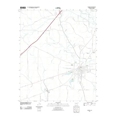
1970 Map of Gurdon
USGS Topo · Published 1972About this map
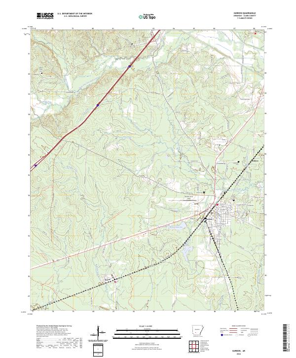
The Missouri Pacific railroad corridor anchors the landscape of southern Clark County, linking the manufacturing and transit hubs of Gurdon and Beirne. Around 1970, Gurdon's industrial and municipal footprint is evidenced by the Gurdon Municipal Airfield, a Substation, and large water bodies like Gurdon Pond No 1. The town is well-served by local institutions, including Rose Hedge Cem and Eastern Star Ch, reflecting its role as a regional center. To the northwest, the rural character remains dominant, defined by the winding course of South Fork Terre Noire Creek and Terre Noire Creek. Scattered settlements like Center Point and several country churches, such as New Casey Ch and South Fork Ch, dot the timbered hills. The presence of a Claypit and Gravel Pit indicates local extractive industries supporting the area's growth during this era of Arkansas development.
Find a feature on this map
39 named features on this map. Tap any name to fly to it.
Don’t see what you’re looking for? This feature index may not catch every label — zoom into the map to look around manually.
Map Details
Editions of this 1970 Gurdon Map
This is the sole edition of this map. No revisions or reprints were ever made.
Historical Maps of Gurdon Through Time
8 maps found