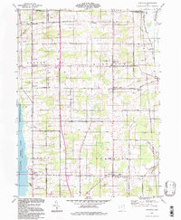
1994 Map of Gustavus
USGS Topo · Published 1997About this map
The Connecticut Western Reserve legacy is evident across this Trumbull County landscape, characterized by the grid-like township boundaries of Greene, Gustavus, Johnston, and Mecca. The western edge is defined by the expanse of Mosquito Lake and the Mosquito Creek Wildlife Area, a significant conservation corridor. Settlement patterns here follow a distinct crossroads logic, with small hamlets like Kenilworth, Barclay, and Johnston serving as local anchors. For genealogists, the map is particularly detailed, locating numerous burial grounds such as the Old Gustavus Cem, Southside Cem, and Evergreen Cem. The terrain is drained by several small watercourses, including Clear Creek and Berry Creek, while the rural road network, featuring routes like Higgins Dorset Rd and Mahan Denman Road, connects the scattered farms and former milling sites like Rices Mills.
Find a feature on this map
52 named features on this map. Tap any name to fly to it.
Don’t see what you’re looking for? This feature index may not catch every label — zoom into the map to look around manually.
Map Details
Editions of this 1994 Gustavus Map
This is the sole edition of this map. No revisions or reprints were ever made.
Other maps of this area

1905 · Andover
USGS Topo · 1:48,000

1905 · Bristolville
USGS Topo · 1:62,500

1905 · Jefferson
USGS Topo · 1:62,500

1907 · Andover
USGS Topo · 1:62,500

1907 · Kinsman
USGS Topo · 1:62,500

1907 · Bristolville
USGS Topo · 1:62,500

1907 · Jefferson
USGS Topo · 1:62,500

1950 · Cleveland
USGS Topo · 1:250,000

1956 · Cleveland
USGS Topo · 1:250,000
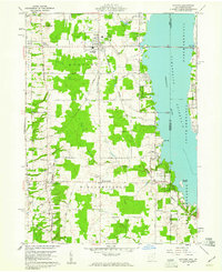
1959 · Andover
USGS Topo · 1:24,000
Featured Places
- Mecca Township, OH
- Mecca, Mecca Township
- Johnston, Johnston Township
- Johnston Township, OH
- Gustavus Township, OH