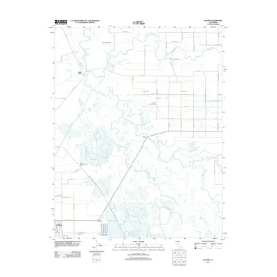
2012 Map of Gustine
USGS Topo · Published 2012About this map
The San Joaquin River and Merced River converge in this fertile stretch of the San Joaquin Valley, defining a landscape shaped by water management and large-scale agriculture. The settlement of Gustine anchors the southwest corner, while the surrounding plains are dotted with significant dairy operations like Borba Dairy Farms and the Stevinson Home Ranch. This 2012 survey illustrates the region's complex hydrography, featuring numerous diversions such as Shag Slough, Mud Slough, and the E Side Irrigation Canal. Historical transit and early river crossings are evident at Hills Ferry and Fremont Ford, points that once served as vital links before modern highway infrastructure. Conservation efforts are represented by the Great Valley Grasslands SP, preserving a remnant of the native landscape amidst the strictly organized grid of agricultural roads like Santa Fe Grade and River Rd.
Find a feature on this map
58 named features on this map. Tap any name to fly to it.
Don’t see what you’re looking for? This feature index may not catch every label — zoom into the map to look around manually.
Map Details
Editions of this 2012 Gustine Map
This is the sole edition of this map. No revisions or reprints were ever made.
Other maps of this area

1916 · Mitchell School
USGS Topo · 1:31,680

1916 · Crows Landing
USGS Topo · 1:31,680

1917 · Turlock
USGS Topo · 1:31,680

1917 · Newman
USGS Topo · 1:31,680

1918 · Stevinson
USGS Topo · 1:31,680

1918 · Gustine
USGS Topo · 1:31,680

1919 · Orestimba
USGS Topo · 1:62,500

1919 · San Luis Ranch
USGS Topo · 1:31,680

1919 · Ingomar
USGS Topo · 1:31,680

1920 · Pacheco Pass
USGS Topo · 1:62,500