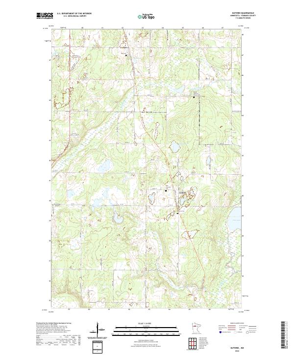
2022 Map of Guthrie
USGS Topo · Published 2022About this map
The small settlement of Guthrie is the central hub of this northern Minnesota landscape, where the Paul Bunyan State Trl follows a linear path north through Nary. This terrain is defined by its glacial hydrology, with numerous small water bodies like Bungashing Cr and Hart Lake interspersed with wetlands and marshy depressions. Local history is anchored by several cemeteries, including Saint Lawrence Cem and Nary Cem, as well as the Malvik Lutheran Church and its accompanying Malvik Lutheran Church Cem. To the west, the Up-Yonder Airport sits near Hatchers Lake, illustrating the varied land use in this part of Hubbard County. The map shows a clear section-line road network, such as CO Hwy 36 and CO Rd 9, which organizes the rural homesteads and agricultural plots surrounding the central Mill Pond.
Find a feature on this map
49 named features on this map. Tap any name to fly to it.
Don’t see what you’re looking for? This feature index may not catch every label — zoom into the map to look around manually.
Map Details
Editions of this 2022 Guthrie Map
This is the sole edition of this map. No revisions or reprints were ever made.
Other maps of this area

1954 · Bemidji
USGS Topo · 1:250,000

1957 · Bemidji
USGS Topo · 1:250,000

1958 · Bemidji
USGS Topo · 1:250,000

1968 · Guthrie
USGS Topo · 1:24,000

1968 · Bemidji East
USGS Topo · 1:24,000

1968 · Frontenac Lake
USGS Topo · 1:24,000

1968 · Bemidji West
USGS Topo · 1:24,000

1972 · Benedict
USGS Topo · 1:24,000

1972 · Laporte
USGS Topo · 1:24,000

1972 · Lake George
USGS Topo · 1:24,000