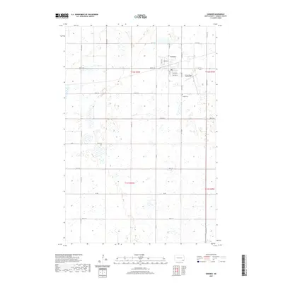
2020 Map of Gwinner
USGS Topo · Published 2020About this map
The city of Gwinner occupies the northeastern corner of this Sargent County survey, serving as a hub of activity in a landscape defined by an extensive network of wetlands and seasonal ponds. This 2020 edition documents the infrastructure supporting the local aviation and agricultural sectors, notably the Gwinner-Roger Melroe Field and a dense grid of rural corridors. The land is precisely divided by roads like 129th Ave SE and 81st St SE, reflecting the systematic township and range organization of North Dakota's eastern plains. To the south of the main settlement, the Gwinner Cem stands as a focal point for genealogical research. The map's detailed hydrography reveals a complex drainage pattern across t132n r56w and t131n r56w, where numerous small water bodies illustrate the prairie pothole geography typical of the region.
Find a feature on this map
28 named features on this map. Tap any name to fly to it.
Don’t see what you’re looking for? This feature index may not catch every label — zoom into the map to look around manually.
Map Details
Editions of this 2020 Gwinner Map
This is the sole edition of this map. No revisions or reprints were ever made.
Other maps of this area

1953 · Fargo
USGS Topo · 1:250,000

1956 · Fargo
USGS Topo · 1:250,000

1957 · Stirum
USGS Topo · 1:24,000

1957 · Cogswell
USGS Topo · 1:24,000

1957 · Elliott SE
USGS Topo · 1:24,000

1958 · Rutland
USGS Topo · 1:24,000
1958 · Forman
USGS Topo · 1:24,000

1960 · Lisbon SE
USGS Topo · 1:24,000
1962 · Hoving
USGS Topo · 1:24,000

1962 · Lisbon SW
USGS Topo · 1:24,000