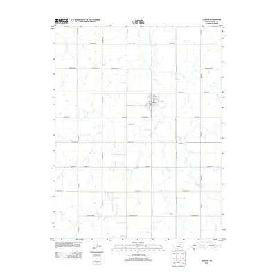
2012 Map of Gypsum
USGS Topo · Published 2012About this map
Gypsum serves as the central hub of this agricultural landscape in Saline County, where a grid of rural roads connects scattered farmsteads across the Kansas plains. The town's small street plan, including 4th St and 5th St, centers around its Po (Post Office), reflecting the localized infrastructure of the early 21st century. The surrounding terrain is defined by a dendritic network of waterways, most notably Gypsum Cr and its tributaries like W Br Gypsum Cr and McAllister Cr. This landscape is particularly rich for family history research, as it preserves the locations of several community landmarks, including Gypsum Cem south of town, Saint Patrick Cem, and Chapel Hill Cem near the southern boundary. These cemeteries and named creek crossings like Stag Cr and Hobbs Cr provide stable reference points for tracing property lines and ancestral homesteads in a region where the natural and human-made grids overlap.
Find a feature on this map
37 named features on this map. Tap any name to fly to it.
Don’t see what you’re looking for? This feature index may not catch every label — zoom into the map to look around manually.
Map Details
Editions of this 2012 Gypsum Map
This is the sole edition of this map. No revisions or reprints were ever made.
Other maps of this area

1889 · Abilene
USGS Topo · 1:125,000

1892 · Salina
USGS Topo · 1:125,000

1894 · Abilene
USGS Topo · 1:125,000

1942 · Salina
USGS Topo · 1:125,000

1955 · Salina
USGS Topo · 1:24,000

1955 · Assaria
USGS Topo · 1:24,000

1955 · Kipp
USGS Topo · 1:24,000

1955 · Gypsum
USGS Topo · 1:24,000

1955 · Hutchinson
USGS Topo · 1:250,000

1959 · Hutchinson
USGS Topo · 1:250,000