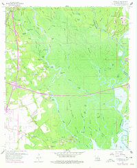
1959 Map of Haaswood
USGS Topo · Published 1978About this map
The Pearl River delta complex dominates this landscape where the Louisiana-Mississippi state line threads through a maze of bayous and cypress-shrouded islands. Settlement patterns here are dictated by the shifting waters of the West Island River and the Middle River, with small communities like Haaswood and Gainesville perched on higher ground. The eastern edge of the map reveals the massive industrial footprint of the Mississippi Test Facility (NASA), a stark technological contrast to the traditional river landings like Porters River Landing and Gum Bayou Landing.
Find a feature on this map
90 named features on this map. Tap any name to fly to it.
Don’t see what you’re looking for? This feature index may not catch every label — zoom into the map to look around manually.
Map Details
Editions of this 1959 Haaswood Map
4 editions found
Other maps of this area

1892 · Chef Menteur
USGS Topo · 1:62,500

1893 · Rigolets
USGS Topo · 1:62,500

1914 · Nicholson
USGS Topo · 1:62,500

1921 · Nicholson
USGS Topo · 1:62,500

1935 · Slidell
USGS Topo · 1:62,500

1935 · English Lookout
USGS Topo · 1:31,680

1936 · North Shore
USGS Topo · 1:31,680

1936 · Chef Menteur
USGS Topo · 1:62,500

1936 · Rigolets
USGS Topo · 1:62,500

1939 · Slidell
USGS Topo · 1:62,500