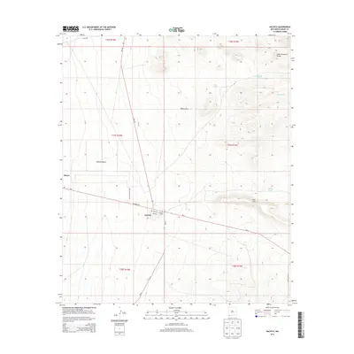
2013 Map of Hachita
USGS Topo · Published 2013About this map
Hachita serves as the central hub of this Chihuahuan Desert landscape, situated where the valley meets the foothills of the Cedar Mountain Range. The town's layout is defined by its transit history, with Railroad Ave, Avenue A, and Avenue B forming the primary grid near the Hachita Cem. The surrounding Hachita Valley is marked by a series of water management features, including S Tank and CC Tank, which support the high-desert cattle ranching economy indicated by Shipping Pens Rd in the southeast.
Find a feature on this map
28 named features on this map. Tap any name to fly to it.
Don’t see what you’re looking for? This feature index may not catch every label — zoom into the map to look around manually.
Map Details
Editions of this 2013 Hachita Map
This is the sole edition of this map. No revisions or reprints were ever made.
Other maps of this area

1918 · Hachita
USGS Topo · 1:62,500

1918 · Victorio
USGS Topo · 1:62,500

1954 · Silver City
USGS Topo · 1:250,000

1955 · Douglas
USGS Topo · 1:250,000

1958 · Silver City
USGS Topo · 1:250,000

1959 · Douglas
USGS Topo · 1:250,000

1961 · Douglas
USGS Topo · 1:250,000

1962 · Silver City
USGS Topo · 1:250,000

1963 · Gage SW
USGS Topo · 1:24,000

1964 · Douglas
USGS Topo · 1:250,000