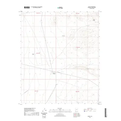
2020 Map of Hachita
USGS Topo · Published 2020About this map
Hachita sits at a geographic crossroads in the high desert of Grant County, where the southern reaches of the Hachita Valley meet the rising slopes of the Cedar Mountain Range. This arid landscape is defined by its water management and transport history, evidenced by a series of named reservoirs like South Tank, Middle Tank, and First Tank that support life and ranching in the Chihuahuan Desert. The settlement's infrastructure follows a clear grid near the intersection of Ave A and Railroad Ave, reflecting its origins as a desert hub. Beyond the town center, the Hachita Cem serves as a vital record for genealogists tracing the families who settled this corner of New Mexico. The terrain is marked by seasonal drainages such as Willow Draw and prominent landforms like Flat Hill, illustrating the isolation and resilience required of those living in the shadow of the mountains.
Find a feature on this map
20 named features on this map. Tap any name to fly to it.
Don’t see what you’re looking for? This feature index may not catch every label — zoom into the map to look around manually.
Map Details
Editions of this 2020 Hachita Map
This is the sole edition of this map. No revisions or reprints were ever made.
Other maps of this area

1918 · Hachita
USGS Topo · 1:62,500

1918 · Victorio
USGS Topo · 1:62,500

1954 · Silver City
USGS Topo · 1:250,000

1955 · Douglas
USGS Topo · 1:250,000

1958 · Silver City
USGS Topo · 1:250,000

1959 · Douglas
USGS Topo · 1:250,000

1961 · Douglas
USGS Topo · 1:250,000

1962 · Silver City
USGS Topo · 1:250,000

1963 · Gage SW
USGS Topo · 1:24,000

1964 · Douglas
USGS Topo · 1:250,000