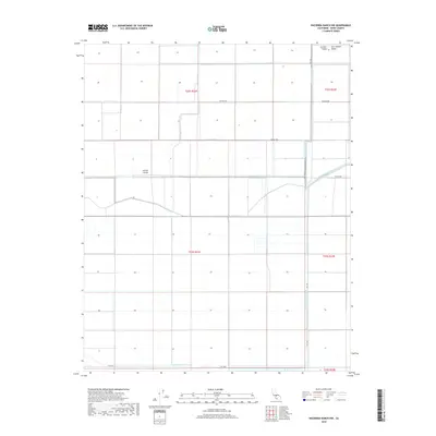
2018 Map of Hacienda Ranch NW
USGS Topo · Published 2018About this map
Pelican Island sits as a prominent feature in this section of the San Joaquin Valley, a landscape defined by the intensive water management systems of the Central Valley. The map reveals a highly structured grid of agricultural tracts and irrigation infrastructure, where the Homeland Canal and Gates Jones Canal facilitate large-scale farming operations. This environment reflects the industrial-scale transformation of the California interior, utilizing a network of named thoroughfares like Seattle Ave and Tehama Ave to navigate the massive sections of the Public Land Survey System. The presence of the Liberty Farms S Canal and Liberty Farms E Canal at the southern edge of the sheet further illustrates the dependency of this region on engineered waterways to support its productivity.
Find a feature on this map
17 named features on this map. Tap any name to fly to it.
Don’t see what you’re looking for? This feature index may not catch every label — zoom into the map to look around manually.
Map Details
Editions of this 2018 Hacienda Ranch NW Map
This is the sole edition of this map. No revisions or reprints were ever made.
Other maps of this area

1914 · Lost Hills
USGS Topo · 1:125,000

1928 · Corcoran
USGS Topo · 1:31,680

1929 · Hacienda Ranch
USGS Topo · 1:31,680

1929 · West Alpaugh
USGS Topo · 1:31,680

1931 · Harvester
USGS Topo · 1:31,680

1932 · El Rico Ranch
USGS Topo · 1:31,680

1932 · Dudley Ridge
USGS Topo · 1:31,680

1932 · West Camp
USGS Topo · 1:31,680

1932 · Lone Tree Well
USGS Topo · 1:31,680

1933 · Chatom Ranch
USGS Topo · 1:31,680