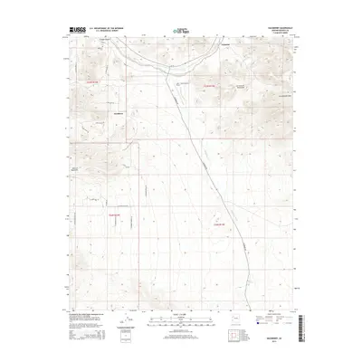
2014 Map of Hackberry
USGS Topo · Published 2014About this map
Az-66 cuts through the high desert of northern Arizona, tracing a corridor of early settlement and transportation history between the Peacock Mountains and the Cottonwood Mountains. This 2014 survey documents the enduring presence of Hackberry and Valentine, communities that grew along the vital water sources and rail paths that preceded the modern highway system. The terrain is defined by the steep Cottonwood Cliffs and deep drainages like Truxton Canyon, where Truxton Wash flows.
Find a feature on this map
33 named features on this map. Tap any name to fly to it.
Don’t see what you’re looking for? This feature index may not catch every label — zoom into the map to look around manually.
Map Details
Editions of this 2014 Hackberry Map
This is the sole edition of this map. No revisions or reprints were ever made.
Other maps of this area

1886 · Diamond Creek
USGS Topo · 1:250,000

1892 · Diamond Creek
USGS Topo · 1:250,000

1948 · Williams
USGS Topo · 1:250,000

1954 · Williams
USGS Topo · 1:250,000

1956 · Williams
USGS Topo · 1:250,000

1960 · Williams
USGS Topo · 1:250,000

1961 · Williams
USGS Topo · 1:250,000
1968 · Peacock Peak
USGS Topo · 1:24,000
1968 · Hualapai Peak NE
USGS Topo · 1:24,000
1968 · Antares
USGS Topo · 1:24,000