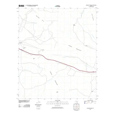
2010 Map of Hackett Peak
USGS Topo · Published 2010About this map
The Carrizo Mountains dominate this West Texas terrain, where the high desert landscape meets the essential infrastructure of the interstate corridor. Centered near the settlement of Crusher, the map documents a region defined by ranching and transit. To the west, Allamoore sits along the path of Interstate 10, while family-held land is marked by the Sammons Ranch and Mann Ranch. Water, the most precious resource in this arid environment, is meticulously traced through landmarks such as Carrizo Spring Windmill, West Windmill, and the winding paths of Carrizo Creek and Mineral Creek. The topography rises sharply toward Hackett Peak and Carrizo Peak, flanked by the Millican Hills and the southern edge of the Beach Mountains, illustrating the complex drainage patterns and elevation changes that dictated the placement of early roads and water sources.
Find a feature on this map
16 named features on this map. Tap any name to fly to it.
Don’t see what you’re looking for? This feature index may not catch every label — zoom into the map to look around manually.
Map Details
Editions of this 2010 Hackett Peak Map
This is the sole edition of this map. No revisions or reprints were ever made.
Other maps of this area

1892 · Chispa
USGS Topo · 1:125,000

1895 · Chispa
USGS Topo · 1:125,000

1895 · Sierra Blanca
USGS Topo · 1:125,000

1897 · Eagle Mountain
USGS Topo · 1:125,000

1897 · Chispa
USGS Topo · 1:125,000

1906 · Van Horn
USGS Topo · 1:125,000

1916 · Eagle Mountain
USGS Topo · 1:125,000

1954 · Van Horn
USGS Topo · 1:250,000

1958 · Van Horn
USGS Topo · 1:250,000

1959 · Marfa
USGS Topo · 1:250,000