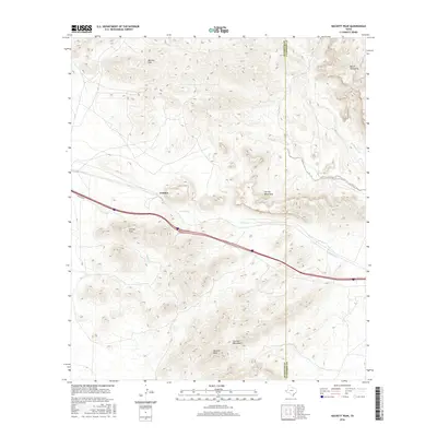
2016 Map of Hackett Peak
USGS Topo · Published 2016About this map
The high desert landscape of West Texas is defined here by the meeting of the Millican Hills and the Beach Mountains. This 2016 survey documents the industrial and geological character of Hudspeth and Culberson Counties, where the small settlement of Crusher sits near the base of the Carrizo Mountains. The topography is dominated by prominent summits including Hackett Peak and Carrizo Peak, which overlook a network of seasonal drainages such as Carrizo Cr, Hackberry Cr, and Mineral Cr. This map captures the modern infrastructure of the region, specifically where the southern desert flats meet the rising limestone and volcanic formations. It provides a clear record of the access roads and land contours surrounding the historical mining and quarrying operations that gave the area its namesake features.
Find a feature on this map
11 named features on this map. Tap any name to fly to it.
Don’t see what you’re looking for? This feature index may not catch every label — zoom into the map to look around manually.
Map Details
Editions of this 2016 Hackett Peak Map
This is the sole edition of this map. No revisions or reprints were ever made.
Other maps of this area

1892 · Chispa
USGS Topo · 1:125,000

1895 · Chispa
USGS Topo · 1:125,000

1895 · Sierra Blanca
USGS Topo · 1:125,000

1897 · Eagle Mountain
USGS Topo · 1:125,000

1897 · Chispa
USGS Topo · 1:125,000

1906 · Van Horn
USGS Topo · 1:125,000

1916 · Eagle Mountain
USGS Topo · 1:125,000

1954 · Van Horn
USGS Topo · 1:250,000

1958 · Van Horn
USGS Topo · 1:250,000

1959 · Marfa
USGS Topo · 1:250,000