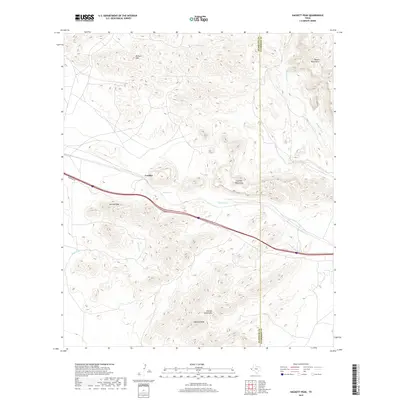
2019 Map of Hackett Peak
USGS Topo · Published 2019About this map
Crusher sits along the major transit corridor of West Texas, positioned between the arid elevations of the Millican Hills and the southern reaches of the Beach Mountains. This 2019 survey documents the rugged geography of the Hudspeth and Culberson County border, a landscape dominated by the prominent heights of Hackett Peak and Carrizo Peak. The drainage patterns of the Trans-Pecos region are visible through the winding paths of Carrizo Creek, Hackberry Creek, and Mineral Creek, which carve through the Carrizo Mountains. The proximity of the primary roadway and its Frontage Road to these landmarks underscores the importance of the narrow passes through these high desert ranges for regional infrastructure.
Find a feature on this map
11 named features on this map. Tap any name to fly to it.
Don’t see what you’re looking for? This feature index may not catch every label — zoom into the map to look around manually.
Map Details
Editions of this 2019 Hackett Peak Map
This is the sole edition of this map. No revisions or reprints were ever made.
Other maps of this area

1892 · Chispa
USGS Topo · 1:125,000

1895 · Chispa
USGS Topo · 1:125,000

1895 · Sierra Blanca
USGS Topo · 1:125,000

1897 · Eagle Mountain
USGS Topo · 1:125,000

1897 · Chispa
USGS Topo · 1:125,000

1906 · Van Horn
USGS Topo · 1:125,000

1916 · Eagle Mountain
USGS Topo · 1:125,000

1954 · Van Horn
USGS Topo · 1:250,000

1958 · Van Horn
USGS Topo · 1:250,000

1959 · Marfa
USGS Topo · 1:250,000