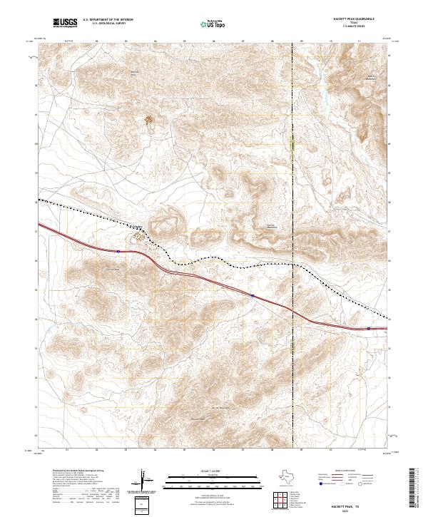
2022 Map of Hackett Peak
USGS Topo · Published 2022About this map
The high Trans-Pecos desert dominates this landscape where the Hudspeth and Culberson County line bisects a network of mountain ranges and drainage basins. Dramatic elevation changes are centered around Hackett Peak and Carrizo Peak, with the northern reaches of the map defined by the Millican Hills and the western edge of the Beach Mountains. This 2022 survey documents a largely undeveloped corridor, where the only significant human mark is the Interstate 10 highway and the industrial settlement at Crusher, situated along the northern foothills of the Carrizo Mountains. The mapping of ephemeral water systems like Carrizo Cr, Hackberry Cr, and Mineral Cr illustrates the complex alluvial patterns that shape this arid terrain. This contemporary data is essential for understanding modern land use and geological formations in this remote section of West Texas.
Find a feature on this map
11 named features on this map. Tap any name to fly to it.
Don’t see what you’re looking for? This feature index may not catch every label — zoom into the map to look around manually.
Map Details
Editions of this 2022 Hackett Peak Map
This is the sole edition of this map. No revisions or reprints were ever made.
Other maps of this area

1892 · Chispa
USGS Topo · 1:125,000

1895 · Chispa
USGS Topo · 1:125,000

1895 · Sierra Blanca
USGS Topo · 1:125,000

1897 · Eagle Mountain
USGS Topo · 1:125,000

1897 · Chispa
USGS Topo · 1:125,000

1906 · Van Horn
USGS Topo · 1:125,000

1916 · Eagle Mountain
USGS Topo · 1:125,000

1954 · Van Horn
USGS Topo · 1:250,000

1958 · Van Horn
USGS Topo · 1:250,000

1959 · Marfa
USGS Topo · 1:250,000