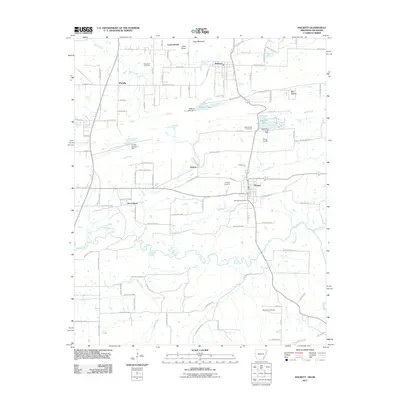
2011 Map of Hackett
USGS Topo · Published 2011About this map
Pocola and Hackett anchor this borderland survey, which documents the rural character and small-town footprints of the Arkansas-Oklahoma state line at the turn of the decade. The landscape is defined by the winding waters of the James Fork and Wells Creek, while human activity is marked by a network of local roads and several small reservoirs, including Sebastian Lake and Wafford Lake. The presence of numerous burial grounds like Macedonia Cemetery and Old Hickory Cemetery provides essential context for family historians tracing early resident lineages in this region. Terrain features such as Gray Mountain and Cedar Knob break the valley floor, overlooking smaller clusters like Bonanza, Jenson, and Rock Island. This 2011 edition shows a well-established road system, transitioning from municipal streets to the numbered county routes that stitch together the farms and creek bottoms of the area.
Find a feature on this map
70 named features on this map. Tap any name to fly to it.
Don’t see what you’re looking for? This feature index may not catch every label — zoom into the map to look around manually.
Map Details
Editions of this 2011 Hackett Map
This is the sole edition of this map. No revisions or reprints were ever made.
Other maps of this area

1879 · Fort Smith
USGS Topo · 1:62,500

1887 · Van Buren
USGS Topo · 1:62,500

1887 · Greenwood
USGS Topo · 1:62,500

1890 · Fort Smith
USGS Topo · 1:125,000

1900 · Sallisaw
USGS Topo · 1:125,000

1911 · Sallisaw
USGS Topo · 1:125,000

1943 · Fort Smith
USGS Topo · 1:125,000

1946 · Fort Smith
USGS Topo · 1:250,000

1947 · Van Buren
USGS Topo · 1:62,500

1947 · Greenwood
USGS Topo · 1:62,500