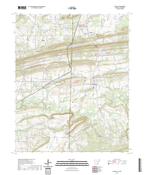
2024 Map of Hackett
USGS Topo · Published 2024About this map
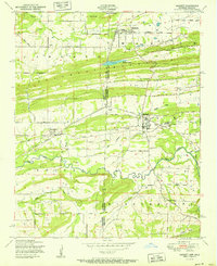
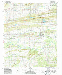
Hackett and Pocola anchor this cross-border landscape where the Ozark foothills meet the Arkansas River Valley. The terrain is defined by the east-west ridges of Backbone Mtn and Scott Ridge, with the Oklahoma-Arkansas state line bisecting the survey. For genealogists and local historians, the area is rich with family-named landmarks and historical burial grounds, including the Old Hickory Cem and Vinita Cem near the town center. The transportation network is built upon the legacy of the Rock Island Rd, reflecting the era's reliance on rail for coal and timber transport. Waterways like the James Fork and Big Branch wind through the valleys, supporting small settlements like Bonanza and Jenson. These communities remain connected by a dense web of local routes such as Pocola Rd and Reaves Ave, providing a clear view of modern parcel development overlaid on long-standing land divisions.
Find a feature on this map
124 named features on this map. Tap any name to fly to it.
Don’t see what you’re looking for? This feature index may not catch every label — zoom into the map to look around manually.
Map Details
Editions of this 2024 Hackett Map
This is the sole edition of this map. No revisions or reprints were ever made.
Historical Maps of Jenson Through Time
4 maps found