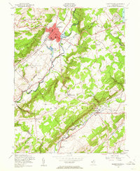
1953 Map of Hackettstown
USGS Topo · Published 1962About this map
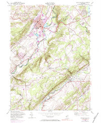
The Musconetcong River valley defines this mid-century landscape, anchoring the bustling borough of Hackettstown. As a regional hub for education and industry, the town is home to Centenary College and a prominent Town Hall, with the Delaware Lackawanna and Western RR providing critical transportation links. Outside the borough, the landscape shifts toward large-scale conservation and recreation, marked by the extensive State Fish Hatchery and the State Game Farm. To the south, the terrain rises into Schooleys Mountain, where rural life is captured through scattered settlements like Drakestown and Pleasant Grove. The South Br Raritan River winds through the southern valleys, passing through Middle Valley and Long Valley, where the Central Railroad of New Jersey follows the water's edge. This 1953 culture revision reveals a period when aviation was taking root in rural Warren and Morris Counties, evidenced by both the Budd Lake Airfield and the Hackettstown Airfield.
Find a feature on this map
58 named features on this map. Tap any name to fly to it.
Don’t see what you’re looking for? This feature index may not catch every label — zoom into the map to look around manually.
Map Details
Editions of this 1953 Hackettstown Map
6 editions found
Other maps of this area

1888 · Hackettstown
USGS Topo · 1:62,500

1888 · Lake Hopatcong
USGS Topo · 1:62,500

1890 · High Bridge
USGS Topo · 1:62,500

1891 · Somerville
USGS Topo · 1:62,500

1893 · Somerville
USGS Topo · 1:62,500

1894 · Hackettstown
USGS Topo · 1:62,500

1894 · Lake Hopatcong
USGS Topo · 1:62,500

1898 · Lake Hopatcong
USGS Topo · 1:62,500

1898 · Hackettstown
USGS Topo · 1:62,500

1898 · High Bridge
USGS Topo · 1:62,500
Featured Places
- Mount Olive, NJ
- Hackettstown, NJ
- Long Valley, Washington Township
- Lebanon Township, NJ
- Washington Township, NJ