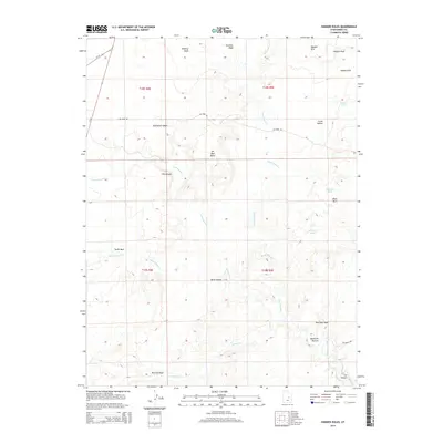
2014 Map of Hadden Holes
USGS Topo · Published 2014About this map
Oil Well Dome stands as a prominent landmark in this desert landscape, where industrial infrastructure meets the intricate drainage systems of central Utah. This 2014 survey reveals a terrain defined by seasonal waterways and dramatic geological formations, with Huntington Cr and Cottonwood Cr carving paths toward the San Rafael River. The map highlights the intersection of natural features and human extraction, evidenced by the eponymous Oil Well Dome and the remote Oil Dome Rd winding through the hills.
Find a feature on this map
32 named features on this map. Tap any name to fly to it.
Don’t see what you’re looking for? This feature index may not catch every label — zoom into the map to look around manually.
Map Details
Editions of this 2014 Hadden Holes Map
This is the sole edition of this map. No revisions or reprints were ever made.
Other maps of this area

1885 · Manti
USGS Topo · 1:250,000

1886 · Price River
USGS Topo · 1:250,000

1895 · Manti
USGS Topo · 1:250,000

1896 · Price River
USGS Topo · 1:250,000

1923 · Castle Dale
USGS Topo · 1:62,500

1923 · Hiawatha
USGS Topo · 1:62,500

1925 · Castle Dale
USGS Topo · 1:62,500

1925 · Hiawatha
USGS Topo · 1:62,500

1953 · Wilsonville SE
USGS Topo · 1:24,000
1954 · Wilsonville SE
USGS Topo · 1:24,000