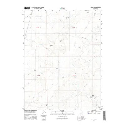
2017 Map of Hadden Holes
USGS Topo · Published 2017About this map
The Wilsonville Cem serves as a quiet marker of early settlement within this desert landscape, situated west of Cottonwood Cr and south of the topographic anomaly known as Oil Well Dome. The terrain is defined by a series of dramatic erosional features including The Breaks, Hadden Hills, and the Hadden Reef, which give way to the lowland Hambrick Bottom where the San Rafael River flows. This 2017 survey reflects the modern hydrologic and transport network of the region, anchored by the historical Green River Cutoff Rd. Named water features like Johansen Pond and Merrials Pond stand out against the arid washes of Wilberg Wash and Fivemile Wash, illustrating the critical nature of water management in this portion of Emery County.
Find a feature on this map
31 named features on this map. Tap any name to fly to it.
Don’t see what you’re looking for? This feature index may not catch every label — zoom into the map to look around manually.
Map Details
Editions of this 2017 Hadden Holes Map
This is the sole edition of this map. No revisions or reprints were ever made.
Other maps of this area

1885 · Manti
USGS Topo · 1:250,000

1886 · Price River
USGS Topo · 1:250,000

1895 · Manti
USGS Topo · 1:250,000

1896 · Price River
USGS Topo · 1:250,000

1923 · Castle Dale
USGS Topo · 1:62,500

1923 · Hiawatha
USGS Topo · 1:62,500

1925 · Castle Dale
USGS Topo · 1:62,500

1925 · Hiawatha
USGS Topo · 1:62,500

1953 · Wilsonville SE
USGS Topo · 1:24,000
1954 · Wilsonville SE
USGS Topo · 1:24,000