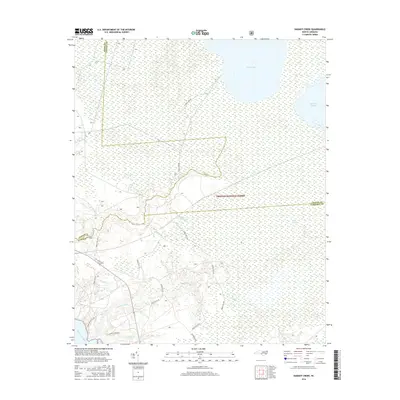
2016 Map of Hadnot Creek
USGS Topo · Published 2016About this map
The Croatan National Forest dominates this coastal North Carolina landscape, where the intersection of Jones, Craven, and Carteret counties meets. Massive water bodies like Great Lake and Lake Ellis Simon characterize the northern portion of the quadrangle, giving way to the dense, saturated terrain of the Lakes Pocosin. This area is defined by its complex hydrography, where the White Oak River and its tributaries, such as Hadnot Creek and Hunters Creek, weave through a network of forest service routes.
Find a feature on this map
26 named features on this map. Tap any name to fly to it.
Don’t see what you’re looking for? This feature index may not catch every label — zoom into the map to look around manually.
Map Details
Editions of this 2016 Hadnot Creek Map
This is the sole edition of this map. No revisions or reprints were ever made.
Other maps of this area

1942 · Maysville
USGS Topo · 1:62,500

1942 · Swansboro
USGS Topo · 1:62,500

1948 · Maysville
USGS Topo · 1:62,500

1948 · Swansboro
USGS Topo · 1:62,500

1949 · Havelock
USGS Topo · 1:24,000

1949 · Salter Path
USGS Topo · 1:24,000

1949 · Masontown
USGS Topo · 1:24,000

1951 · Salter Path
USGS Topo · 1:24,000

1951 · Masontown
USGS Topo · 1:24,000

1952 · Hubert
USGS Topo · 1:24,000