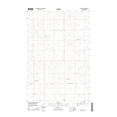
2014 Map of Hafla School
USGS Topo · Published 2014About this map
Hafla School stands as a lonely landmark in this Garfield County interior, illustrating the sparse settlement patterns of the Montana plains in the early 21st century. The landscape is defined by its drainages, where Taylor Cr and Hawks Nest Cr carve through the terrain. Evidence of local aviation and transportation appears in the form of the Pluhar Airport and the descriptively named Two Furrow Rd, which suggests the practical, unpaved nature of rural access in this region. To the south, Skunk Arroyo and Witchie Coulee provide significant topographical relief. This survey captures a specific moment of ranching and rural infrastructure, documenting the few named points of interest that anchor this remote part of the Missouri River country.
Find a feature on this map
14 named features on this map. Tap any name to fly to it.
Don’t see what you’re looking for? This feature index may not catch every label — zoom into the map to look around manually.
Map Details
Editions of this 2014 Hafla School Map
This is the sole edition of this map. No revisions or reprints were ever made.
Other maps of this area

1954 · Jordan
USGS Topo · 1:250,000

1956 · Jordan
USGS Topo · 1:250,000

1958 · Jordan
USGS Topo · 1:250,000

1964 · Jordan
USGS Topo · 1:250,000

1964 · Ada Creek
USGS Topo · 1:24,000

1965 · Cohagen
USGS Topo · 1:24,000

1965 · Whiteside Ranch
USGS Topo · 1:24,000

1965 · Calamity Coulee
USGS Topo · 1:24,000

1965 · Hafla School
USGS Topo · 1:24,000
1965 · Sleepy Hollow
USGS Topo · 1:24,000