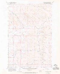
1965 Map of Sleepy Hollow
USGS Topo · Published 1969About this map
The high plains of Garfield County are defined by an intricate drainage system in this mid-1960s landscape. Water management and livestock operations appear as the primary human signatures on the land, evidenced by the Stebbins Windmill and several named Wells scattered across the coulees. The Little Dry Water Users Association Canal cuts across the northeastern terrain, illustrating the organized efforts of local residents to divert Little Dry Creek for agricultural or ranching utility in this arid environment.
Find a feature on this map
15 named features on this map. Tap any name to fly to it.
Don’t see what you’re looking for? This feature index may not catch every label — zoom into the map to look around manually.
Map Details
Editions of this 1965 Sleepy Hollow Map
This is the sole edition of this map. No revisions or reprints were ever made.
Other maps of this area

1954 · Jordan
USGS Topo · 1:250,000

1954 · Forsyth
USGS Topo · 1:250,000

1956 · Jordan
USGS Topo · 1:250,000

1957 · Forsyth
USGS Topo · 1:250,000

1958 · Jordan
USGS Topo · 1:250,000

1958 · Forsyth
USGS Topo · 1:250,000

1964 · Jordan
USGS Topo · 1:250,000

1965 · Little Chalk Butte
USGS Topo · 1:24,000

1965 · Whiteside Ranch
USGS Topo · 1:24,000

1965 · Calamity Coulee
USGS Topo · 1:24,000