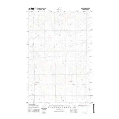
2017 Map of Hafla School
USGS Topo · Published 2017About this map
Hafla School stands as a lonely landmark in this high-plains landscape of Garfield County, marking a site of community importance in an area characterized by scattered homesteads and vast drainage systems. The terrain is defined by the winding course of Taylor Cr and Hawks Nest Cr, which cut through the landscape alongside features like Witchie Coulee. The map illustrates a network of rural routes, including the descriptive Two Furrows Rd and Ross Rd, which connect the isolated holdings of this ranching country.
Find a feature on this map
13 named features on this map. Tap any name to fly to it.
Don’t see what you’re looking for? This feature index may not catch every label — zoom into the map to look around manually.
Map Details
Editions of this 2017 Hafla School Map
This is the sole edition of this map. No revisions or reprints were ever made.
Other maps of this area

1954 · Jordan
USGS Topo · 1:250,000

1956 · Jordan
USGS Topo · 1:250,000

1958 · Jordan
USGS Topo · 1:250,000

1964 · Jordan
USGS Topo · 1:250,000

1964 · Ada Creek
USGS Topo · 1:24,000

1965 · Cohagen
USGS Topo · 1:24,000

1965 · Whiteside Ranch
USGS Topo · 1:24,000

1965 · Calamity Coulee
USGS Topo · 1:24,000

1965 · Hafla School
USGS Topo · 1:24,000
1965 · Sleepy Hollow
USGS Topo · 1:24,000