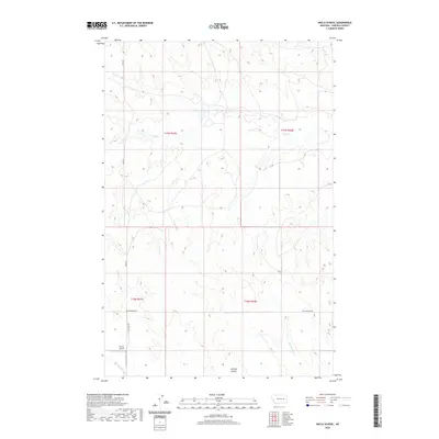
2020 Map of Hafla School
USGS Topo · Published 2020About this map
Pluhar Airport anchors the lower-left corner of this Garfield County landscape, serving as a rare point of aviation infrastructure in a largely open ranching region. This 2020 topographic record details the intricate drainage networks that carve through the Montana terrain, notably the winding courses of Taylor Cr and Hawks Nest Cr. The map's labeling reveals a transition from traditional coulee-fed plains to the more distinct topography near Witchie Coulee.
Find a feature on this map
12 named features on this map. Tap any name to fly to it.
Don’t see what you’re looking for? This feature index may not catch every label — zoom into the map to look around manually.
Map Details
Editions of this 2020 Hafla School Map
This is the sole edition of this map. No revisions or reprints were ever made.
Other maps of this area

1954 · Jordan
USGS Topo · 1:250,000

1956 · Jordan
USGS Topo · 1:250,000

1958 · Jordan
USGS Topo · 1:250,000

1964 · Jordan
USGS Topo · 1:250,000

1964 · Ada Creek
USGS Topo · 1:24,000

1965 · Cohagen
USGS Topo · 1:24,000

1965 · Whiteside Ranch
USGS Topo · 1:24,000

1965 · Calamity Coulee
USGS Topo · 1:24,000

1965 · Hafla School
USGS Topo · 1:24,000
1965 · Sleepy Hollow
USGS Topo · 1:24,000