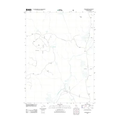
2012 Map of Hager Basin
USGS Topo · Published 2012About this map
Hager Ranch and Avanzino Ranch occupy the lowlands of this High Desert territory in Modoc County, where the management of water is the primary footprint on the land. The landscape is defined by a network of engineered water sources, including the Hager Basin Reservoir, Avanzino Reservoir, and several stock tanks like the Blue Mountain Meadows Tank and Garden Tank. These features, alongside named springs such as Blue Mountain Spring and Boles Spring, underscore the region's reliance on limited water resources for ranching.
Find a feature on this map
20 named features on this map. Tap any name to fly to it.
Don’t see what you’re looking for? This feature index may not catch every label — zoom into the map to look around manually.
Map Details
Editions of this 2012 Hager Basin Map
This is the sole edition of this map. No revisions or reprints were ever made.
Other maps of this area

1886 · Alturas
USGS Topo · 1:250,000

1892 · Alturas
USGS Topo · 1:250,000

1954 · Alturas
USGS Topo · 1:250,000

1958 · Alturas
USGS Topo · 1:250,000

1962 · Alturas
USGS Topo · 1:250,000

1962 · Big Sage Reservoir
USGS Topo · 1:62,500

1962 · Steele Swamp
USGS Topo · 1:62,500

1962 · South Mountain
USGS Topo · 1:62,500

1962 · Jacks Butte
USGS Topo · 1:62,500

1965 · Alturas
USGS Topo · 1:250,000