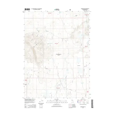
2015 Map of Hager Basin
USGS Topo · Published 2015About this map
The high-desert terrain of Modoc National Forest dominates this northeastern California landscape, characterized by isolated peaks and seasonal water management. Significant landmarks include the prominent elevation of Blue Mtn and its East Point, alongside Huffman Butte to the north. This area of Modoc County is defined by its water infrastructure, which is vital for ranching and forest management. Several catchment points such as Avanzino Reservoir, Dry Valley Reservoir, and Hager Basin Reservoir are distributed across the basin. Localized water sources like Tramp Spring, Boles Spring, and Blue Mountain Spring provide essential moisture in this arid environment. The map details the local road network, including the Crowder Flat and Willow Loop routes, which navigate the varied topography from the lower Hager Basin up toward the densely forested slopes of Timbered Ridge.
Find a feature on this map
31 named features on this map. Tap any name to fly to it.
Don’t see what you’re looking for? This feature index may not catch every label — zoom into the map to look around manually.
Map Details
Editions of this 2015 Hager Basin Map
This is the sole edition of this map. No revisions or reprints were ever made.
Other maps of this area

1886 · Alturas
USGS Topo · 1:250,000

1892 · Alturas
USGS Topo · 1:250,000

1954 · Alturas
USGS Topo · 1:250,000

1958 · Alturas
USGS Topo · 1:250,000

1962 · Alturas
USGS Topo · 1:250,000

1962 · Big Sage Reservoir
USGS Topo · 1:62,500

1962 · Steele Swamp
USGS Topo · 1:62,500

1962 · South Mountain
USGS Topo · 1:62,500

1962 · Jacks Butte
USGS Topo · 1:62,500

1965 · Alturas
USGS Topo · 1:250,000