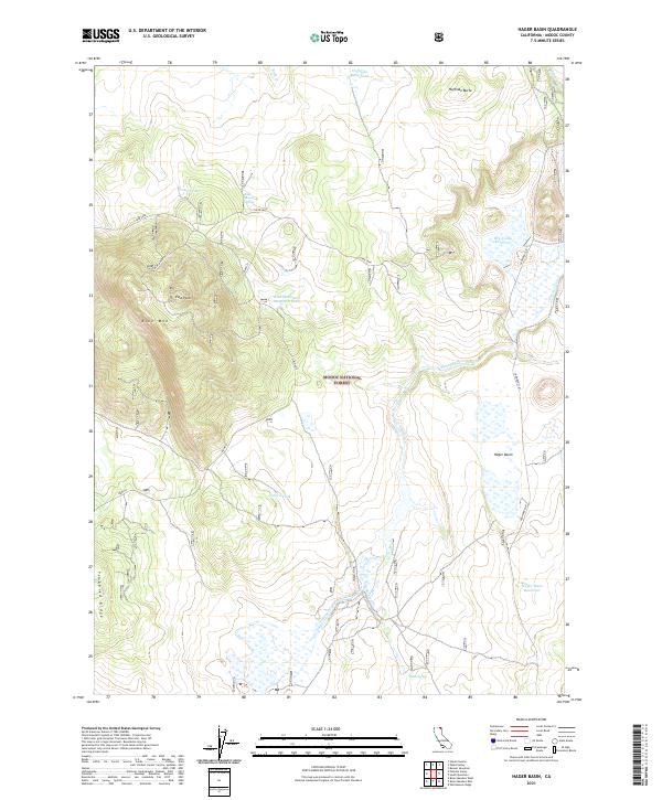
2021 Map of Hager Basin
USGS Topo · Published 2021About this map
Modoc National Forest encompasses this high-elevation landscape, where cattle ranching and water management define the local geography. The area is marked by a network of essential water sources for livestock and wildlife, including Huffman Butte Tank, Garden Tank, and the Blue Mountain Meadows Tank. High points like Blue Mountain, featuring the Blue Mountain Lookout, and East Point provide vantage points over the surrounding terrain.
Find a feature on this map
28 named features on this map. Tap any name to fly to it.
Don’t see what you’re looking for? This feature index may not catch every label — zoom into the map to look around manually.
Map Details
Editions of this 2021 Hager Basin Map
This is the sole edition of this map. No revisions or reprints were ever made.
Other maps of this area

1886 · Alturas
USGS Topo · 1:250,000

1892 · Alturas
USGS Topo · 1:250,000

1954 · Alturas
USGS Topo · 1:250,000

1958 · Alturas
USGS Topo · 1:250,000

1962 · Alturas
USGS Topo · 1:250,000

1962 · Big Sage Reservoir
USGS Topo · 1:62,500

1962 · Steele Swamp
USGS Topo · 1:62,500

1962 · South Mountain
USGS Topo · 1:62,500

1962 · Jacks Butte
USGS Topo · 1:62,500

1965 · Alturas
USGS Topo · 1:250,000