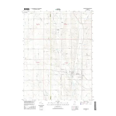
2016 Map of Hagerstown
USGS Topo · Published 2016About this map
Hagerstown anchors the southeastern portion of this survey, situated at the confluence of several vital watercourses including the Whitewater River and Nettle Cr. The landscape transitions from the agricultural plateaus of the west to a dense network of smaller drainages such as Wilbur Wright Cr and Propeller Run. This concentration of water resources supported the growth of clustered settlements like Dalton and Franklin along the primary north-south corridors.
Find a feature on this map
91 named features on this map. Tap any name to fly to it.
Don’t see what you’re looking for? This feature index may not catch every label — zoom into the map to look around manually.
Map Details
Editions of this 2016 Hagerstown Map
This is the sole edition of this map. No revisions or reprints were ever made.
Other maps of this area

1948 · Lewisville
USGS Topo · 1:24,000

1950 · New Castle East
USGS Topo · 1:24,000

1950 · Lewisville
USGS Topo · 1:24,000

1953 · Cincinnati
USGS Topo · 1:250,000

1953 · Muncie
USGS Topo · 1:250,000

1956 · Muncie
USGS Topo · 1:250,000

1957 · Cincinnati
USGS Topo · 1:250,000

1960 · New Castle East
USGS Topo · 1:24,000

1960 · Mount Pleasant
USGS Topo · 1:24,000

1960 · Carlos
USGS Topo · 1:24,000