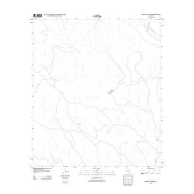
2012 Map of Hagler Canyon
USGS Topo · Published 2012About this map
Hagler Canyon and its complex network of drainage systems define this arid Brewster County landscape. This 2012 survey captures the character of the Trans-Pecos region, where natural features like Whitely Canyon and Putman Canyon serve as the primary landmarks in an area of sparse human infrastructure. Watercourses such as Sanderson Cr and Cedar Cr are the lifeblood of the terrain, though they often flow intermittently. Modern access to these isolated reaches is facilitated by a few key corridors, including Cochran Rd in the north and Five Mile Hill Rd in the southeast. The map reflects a landscape where the topography remains the dominant feature, providing a clear record of the West Texas back-country in the early twenty-first century.
Find a feature on this map
7 named features on this map. Tap any name to fly to it.
Don’t see what you’re looking for? This feature index may not catch every label — zoom into the map to look around manually.
Map Details
Editions of this 2012 Hagler Canyon Map
This is the sole edition of this map. No revisions or reprints were ever made.
Other maps of this area

1918 · Bullis Gap
USGS Topo · 1:62,500

1918 · Indian Wells
USGS Topo · 1:62,500

1920 · Longfellow
USGS Topo · 1:125,000

1928 · Sanderson
USGS Topo · 1:125,000

1954 · Fort Stockton
USGS Topo · 1:250,000

1958 · Fort Stockton
USGS Topo · 1:250,000

1959 · Emory Peak
USGS Topo · 1:250,000

1965 · Emory Peak
USGS Topo · 1:250,000

1968 · Big Brindle Canyon
USGS Topo · 1:24,000

1968 · Ninemile Ranch
USGS Topo · 1:24,000