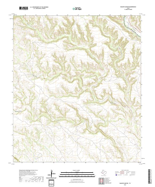
2022 Map of Hagler Canyon
USGS Topo · Published 2022About this map
Hagler Canyon and Washboard Canyon characterize this deeply dissected corner of West Texas, where the terrain falls away toward the Rio Grande valley. The map documents a landscape defined by an intricate network of dry washes and limestone drainages, including the prominent Isinglass Canyon and Putman Canyon. These seasonal watercourses dictate the local geography, converging toward larger arteries like Sanderson Canyon and Sanderson Cr.
Find a feature on this map
11 named features on this map. Tap any name to fly to it.
Don’t see what you’re looking for? This feature index may not catch every label — zoom into the map to look around manually.
Map Details
Editions of this 2022 Hagler Canyon Map
This is the sole edition of this map. No revisions or reprints were ever made.
Other maps of this area

1918 · Bullis Gap
USGS Topo · 1:62,500

1918 · Indian Wells
USGS Topo · 1:62,500

1920 · Longfellow
USGS Topo · 1:125,000

1928 · Sanderson
USGS Topo · 1:125,000

1954 · Fort Stockton
USGS Topo · 1:250,000

1958 · Fort Stockton
USGS Topo · 1:250,000

1959 · Emory Peak
USGS Topo · 1:250,000

1965 · Emory Peak
USGS Topo · 1:250,000

1968 · Big Brindle Canyon
USGS Topo · 1:24,000

1968 · Ninemile Ranch
USGS Topo · 1:24,000