
1938 Map of Hagood
USGS Topo · Published 1938About this map
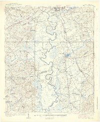
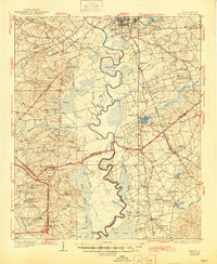
The Wateree River snakes through the heart of this South Carolina landscape, defining the boundaries between Kershaw, Richland, and Sumter counties in the mid-1930s. The river's winding course creates dramatic features like Belmont Neck and the sharp turn at Devils Elbow. Industry and agriculture are anchored by water power at Hermitage Mill and Boykin Mill Pond, while the transit network shows signs of transition with the Ancrum Ferry (Abandoned) and a developing system of railroads including the Seaboard Air Line and Southern.
Find a feature on this map
92 named features on this map. Tap any name to fly to it.
Don’t see what you’re looking for? This feature index may not catch every label — zoom into the map to look around manually.
Map Details
Editions of this 1938 Hagood Map
3 editions found
Other maps of this area

1935 · Camden
USGS Topo · 1:48,000

1935 · Killian
USGS Topo · 1:48,000

1937 · Killian
USGS Topo · 1:62,500

1938 · Camden
USGS Topo · 1:62,500

1941 · Spartanburg
USGS Topo · 1:250,000

1942 · Camden
USGS Topo · 1:125,000

1943 · Eastover
USGS Topo · 1:62,500

1946 · Sumter
USGS Topo · 1:62,500

1948 · Hopkins
USGS Topo · 1:62,500

1953 · Camden South
USGS Topo · 1:24,000