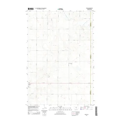
2014 Map of Hague
USGS Topo · Published 2014About this map
Hague serves as the primary settlement on this landscape in the southeastern corner of Emmons County. Situated near the border with McIntosh County, this prairie community is anchored by local history markers such as Saint Marys Cem, which lies just south of the town center. The terrain is defined by the subtle drainage patterns of the S Branch Beaver Creek, which meanders through the northern sections of the quadrangle. Outside the main cluster of Hague, the land is organized into a rigid grid of agricultural roads, including Hulm Dr and numerous numbered avenues. A notable landmark for regional aviation, the Schumacher Strip Airport, is positioned north of the town, illustrating the necessity of private air travel in this expansive rural environment. This map reflects a post-millennial snapshot of the region, documenting the enduring footprint of small-town North Dakota and the surrounding farmsteads.
Find a feature on this map
21 named features on this map. Tap any name to fly to it.
Don’t see what you’re looking for? This feature index may not catch every label — zoom into the map to look around manually.
Map Details
Editions of this 2014 Hague Map
This is the sole edition of this map. No revisions or reprints were ever made.
Other maps of this area

1953 · Jamestown
USGS Topo · 1:250,000

1953 · McIntosh
USGS Topo · 1:250,000

1954 · Aberdeen
USGS Topo · 1:250,000

1954 · Bismarck
USGS Topo · 1:250,000

1956 · Aberdeen
USGS Topo · 1:250,000

1956 · Jamestown
USGS Topo · 1:250,000

1958 · Bismarck
USGS Topo · 1:250,000

1958 · McIntosh
USGS Topo · 1:250,000

1965 · Herreid NE
USGS Topo · 1:24,000

1978 · Zeeland
USGS Topo · 1:24,000