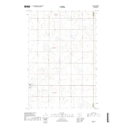
2017 Map of Hague
USGS Topo · Published 2017About this map
Hague sits in the southwestern portion of this prairie landscape, serving as a primary point of settlement along the border of Emmons and McIntosh Counties. This area of North Dakota is defined by a grid of section lines and gravel roads, including 90th St SE and 19th Ave SE, which organize the vast agricultural and wetland terrain. A notable cultural site is the Saint Marys Cem, located just south of the town center. The landscape is dotted with numerous small prairie potholes and ephemeral wetlands, characteristic of the glaciated plains. The map provides a detailed view of rural land management in townships t131n r74w, t130n r74w, and t129n r74w, where family-named routes like Hulm Dr deviate from the standard cardinal grid.
Find a feature on this map
20 named features on this map. Tap any name to fly to it.
Don’t see what you’re looking for? This feature index may not catch every label — zoom into the map to look around manually.
Map Details
Editions of this 2017 Hague Map
This is the sole edition of this map. No revisions or reprints were ever made.
Other maps of this area

1953 · Jamestown
USGS Topo · 1:250,000

1953 · McIntosh
USGS Topo · 1:250,000

1954 · Aberdeen
USGS Topo · 1:250,000

1954 · Bismarck
USGS Topo · 1:250,000

1956 · Aberdeen
USGS Topo · 1:250,000

1956 · Jamestown
USGS Topo · 1:250,000

1958 · Bismarck
USGS Topo · 1:250,000

1958 · McIntosh
USGS Topo · 1:250,000

1965 · Herreid NE
USGS Topo · 1:24,000

1978 · Zeeland
USGS Topo · 1:24,000