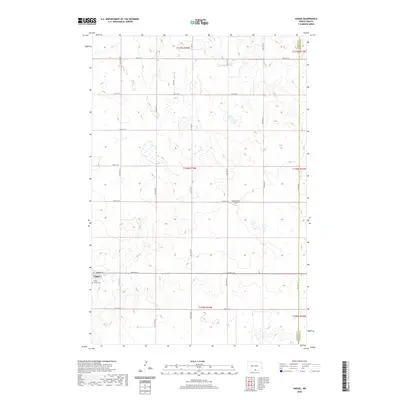
2020 Map of Hague
USGS Topo · Published 2020About this map
Hague anchors this pocket of the North Dakota plains, a town organized along Main St and surrounded by a vast grid of section-line roads. The landscape is defined by the high-plains geography of the Missouri Plateau, where numerous small seasonal wetlands and depressions are scattered across the townships. At the southern edge of the settlement lies Saint Marys Cem, a primary site for genealogical research in this rural community. To the northeast, the Schumacher Strip airfield represents the local aviation history essential to large-scale agricultural operations. The border between Emmons and McIntosh Counties runs along the eastern edge of the quadrangle, where the township and range system partitions the land into precise squares for farming and ranching.
Find a feature on this map
26 named features on this map. Tap any name to fly to it.
Don’t see what you’re looking for? This feature index may not catch every label — zoom into the map to look around manually.
Map Details
Editions of this 2020 Hague Map
This is the sole edition of this map. No revisions or reprints were ever made.
Other maps of this area

1953 · Jamestown
USGS Topo · 1:250,000

1953 · McIntosh
USGS Topo · 1:250,000

1954 · Aberdeen
USGS Topo · 1:250,000

1954 · Bismarck
USGS Topo · 1:250,000

1956 · Aberdeen
USGS Topo · 1:250,000

1956 · Jamestown
USGS Topo · 1:250,000

1958 · Bismarck
USGS Topo · 1:250,000

1958 · McIntosh
USGS Topo · 1:250,000

1965 · Herreid NE
USGS Topo · 1:24,000

1978 · Zeeland
USGS Topo · 1:24,000