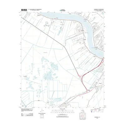
2012 Map of Hahnville
USGS Topo · Published 2012About this map
The Mississippi River carves a wide arc through this part of St. Charles Parish, anchoring a landscape where industrial infrastructure and traditional riverfront settlements coexist. The west bank is defined by the community of Hahnville, featuring its namesake Hahnville Landing, while the east bank hosts the industry-heavy corridor of Norco, Good Hope, and New Sarpy. This river-centric geography is reflected in the numerous riverfront access points like Ormond Landing and the significant Waterford Revetment protecting the bank.
Find a feature on this map
132 named features on this map. Tap any name to fly to it.
Don’t see what you’re looking for? This feature index may not catch every label — zoom into the map to look around manually.
Map Details
Editions of this 2012 Hahnville Map
This is the sole edition of this map. No revisions or reprints were ever made.
Other maps of this area

1891 · Hahnville
USGS Topo · 1:62,500

1892 · Lac Des Allemands
USGS Topo · 1:62,500

1892 · Mount Airy
USGS Topo · 1:62,500

1892 · Bonnet Carre
USGS Topo · 1:62,500

1932 · Lac Des Allemands SE
USGS Topo · 1:31,680

1932 · Hahnville NW
USGS Topo · 1:31,680

1932 · Lac Des Allemands NE
USGS Topo · 1:31,680

1932 · Hahnville SW
USGS Topo · 1:31,680

1932 · Hahnville NE
USGS Topo · 1:31,680

1935 · Laplace
USGS Topo · 1:31,680