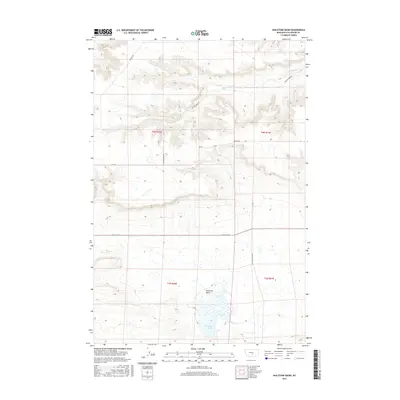
2017 Map of Hailstone Basin
USGS Topo · Published 2017About this map
Hailstone Basin and its surrounding landscape are defined by a network of drainage systems and isolated upland plateaus in Stillwater County. The southern portion of this region is dominated by Hailstone Lake, a central hydrological feature within the basin itself. To the north, the terrain transitions into a series of intricately carved coulees and ridges where Painted Robe Cr and its tributaries have etched deep patterns into the earth. Local transit is largely dictated by the topography, with Painted Robe Rd following the natural contours of the valley floor, while other routes like Kunesh Rd and Hoagland Rd delineate the boundaries between higher grazing lands and the lower basins. The map illustrates a typical Montana rangeland layout, emphasizing the relationship between limited water sources and the road systems that navigate the land's structural folds.
Find a feature on this map
13 named features on this map. Tap any name to fly to it.
Don’t see what you’re looking for? This feature index may not catch every label — zoom into the map to look around manually.
Map Details
Editions of this 2017 Hailstone Basin Map
This is the sole edition of this map. No revisions or reprints were ever made.
Other maps of this area

1889 · Big Snowy Mountain
USGS Topo · 1:250,000

1892 · Stillwater
USGS Topo · 1:125,000

1893 · Big Snowy Mountain
USGS Topo · 1:250,000

1954 · Billings
USGS Topo · 1:250,000

1954 · Roundup
USGS Topo · 1:250,000

1956 · Rapelje
USGS Topo · 1:24,000

1956 · Battle Butte
USGS Topo · 1:24,000

1956 · Wheat Basin
USGS Topo · 1:24,000

1957 · Billings
USGS Topo · 1:250,000

1958 · Billings
USGS Topo · 1:250,000