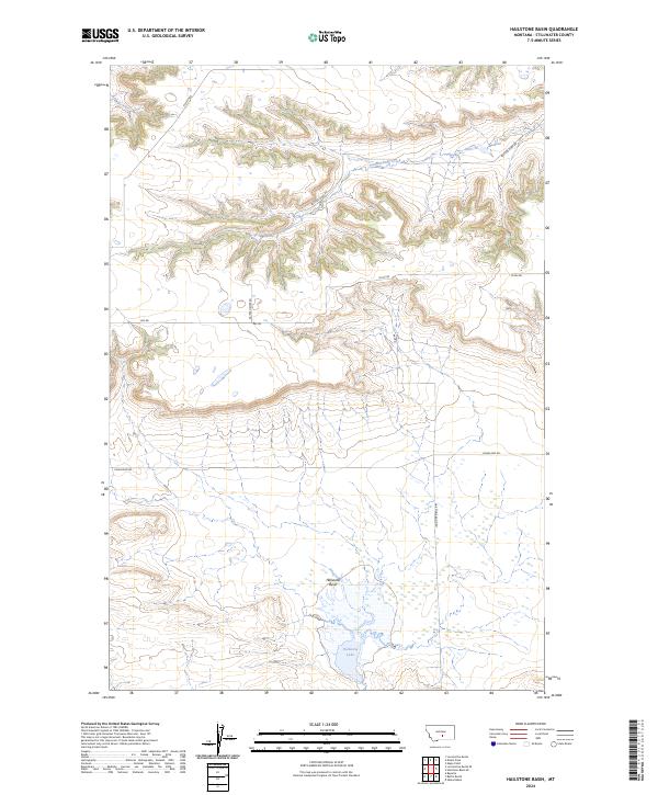
2024 Map of Hailstone Basin
USGS Topo · Published 2024About this map
Hailstone National Wildlife Refuge anchors the southeast corner of this Stillwater County landscape, preserving the alkaline waters of Hailstone Lake and the surrounding prairie habitat. The terrain is defined by the Hailstone Basin, where the elevation drops into a natural depression, and the northern drainage of Painted Robe Creek. This modern survey illustrates the sparse, grid-based road network characteristic of Montana's high plains, where long stretches of road like Painted Robe Rd, Ray Rd, and Hoagland Rd serve remote ranchlands. The map provides a clear look at the intersection of public conservation land and private township divisions, including t4n r20e and t3n r21e. It is a vital document for understanding the contemporary geography of this wind-swept basin and its essential water features.
Find a feature on this map
14 named features on this map. Tap any name to fly to it.
Don’t see what you’re looking for? This feature index may not catch every label — zoom into the map to look around manually.
Map Details
Editions of this 2024 Hailstone Basin Map
This is the sole edition of this map. No revisions or reprints were ever made.
Other maps of this area

1889 · Big Snowy Mountain
USGS Topo · 1:250,000

1892 · Stillwater
USGS Topo · 1:125,000

1893 · Big Snowy Mountain
USGS Topo · 1:250,000

1954 · Billings
USGS Topo · 1:250,000

1954 · Roundup
USGS Topo · 1:250,000

1956 · Rapelje
USGS Topo · 1:24,000

1956 · Battle Butte
USGS Topo · 1:24,000

1956 · Wheat Basin
USGS Topo · 1:24,000

1957 · Billings
USGS Topo · 1:250,000

1958 · Billings
USGS Topo · 1:250,000