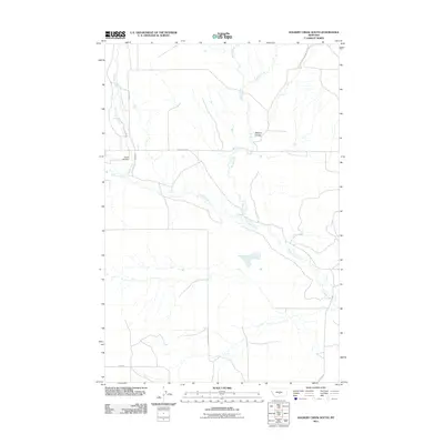
2011 Map of Halbert Creek South
USGS Topo · Published 2011About this map
Careless Creek snakes through this Wheatland County landscape, providing a primary drainage route for the surrounding high plains. The area is defined by its rural road network, with routes like Hedgesville Rd and Wallum Rd connecting isolated ranchlands and crossing various watercourses. Significant for genealogical research, the Hedges Cemetery and a second marked Cemetery are situated near the western edge of the sheet, indicating early community centers or family plots within this expansive grazing country. The terrain is marked by seasonal water flow and drainage features such as Walters Coulee, while Spring Creek and Halbert Creek feed into the larger creek systems. This 2011 survey reflects the enduring cattle-country character of the region, where the placement of small cemeteries and the alignment of section-line roads like 12 E 116 N Rd continue to shape the local geography.
Find a feature on this map
10 named features on this map. Tap any name to fly to it.
Don’t see what you’re looking for? This feature index may not catch every label — zoom into the map to look around manually.
Map Details
Editions of this 2011 Halbert Creek South Map
This is the sole edition of this map. No revisions or reprints were ever made.
Other maps of this area

1889 · Big Snowy Mountain
USGS Topo · 1:250,000

1893 · Big Snowy Mountain
USGS Topo · 1:250,000

1954 · Roundup
USGS Topo · 1:250,000

1958 · Roundup
USGS Topo · 1:250,000

1986 · Ryegate West
USGS Topo · 1:24,000

1986 · Shawmut
USGS Topo · 1:24,000

1986 · Halbert Creek South
USGS Topo · 1:24,000
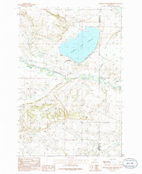
1986 · Deadmans Basin Reservoir
USGS Topo · 1:24,000

1986 · Halbert Creek North
USGS Topo · 1:24,000

1986 · Wallum
USGS Topo · 1:24,000