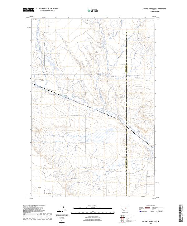
2024 Map of Halbert Creek South
USGS Topo · Published 2024About this map
Careless Creek meanders through this section of the Montana landscape, marking a terrain defined by drainage patterns and rural infrastructure. The boundary between Wheatland Co and Golden Valley Co cuts through the eastern portion of the map, dividing a region primarily shaped by agricultural and aviation history. Local land use is centered around landmarks like Lammers Airport and the Hedgesville Cem, which sit near the intersection of various rural routes such as 12e116n. The presence of several distinct watercourses, including Spring Creek and Halbert Creek, indicates a complex system of seasonal and perennial flows draining into Walters Coulee. To the south, the development of Basin Acres introduces a more modern residential pattern amidst the established ranching and township lines of t8n r18e and t7n r18e.
Find a feature on this map
20 named features on this map. Tap any name to fly to it.
Don’t see what you’re looking for? This feature index may not catch every label — zoom into the map to look around manually.
Map Details
Editions of this 2024 Halbert Creek South Map
This is the sole edition of this map. No revisions or reprints were ever made.
Other maps of this area

1889 · Big Snowy Mountain
USGS Topo · 1:250,000

1893 · Big Snowy Mountain
USGS Topo · 1:250,000

1954 · Roundup
USGS Topo · 1:250,000

1958 · Roundup
USGS Topo · 1:250,000

1986 · Ryegate West
USGS Topo · 1:24,000

1986 · Shawmut
USGS Topo · 1:24,000

1986 · Halbert Creek South
USGS Topo · 1:24,000
1986 · Deadmans Basin Reservoir
USGS Topo · 1:24,000

1986 · Halbert Creek North
USGS Topo · 1:24,000

1986 · Wallum
USGS Topo · 1:24,000