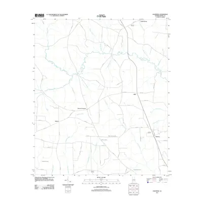
2011 Map of Haleburg
USGS Topo · Published 2011About this map
Haleburg and the rural crossroads of eastern Henry County are defined by a dense network of watercourses and family burial grounds in this 2011 survey. The landscape is carved by the winding paths of Abbie Creek, Sandy Creek, and Foster Creek, which dictate the placement of early settlements and road junctions. For genealogists, the map is remarkably dense with named cemeteries, ranging from Adoniram Cemetery in the north to Granberry Cemetery and Camp Springs Cemetery in the south, providing a clear spatial record of the area's ancestral hubs.
Find a feature on this map
66 named features on this map. Tap any name to fly to it.
Don’t see what you’re looking for? This feature index may not catch every label — zoom into the map to look around manually.
Map Details
Editions of this 2011 Haleburg Map
This is the sole edition of this map. No revisions or reprints were ever made.
Other maps of this area

1953 · Dothan
USGS Topo · 1:250,000

1954 · Dothan
USGS Topo · 1:250,000

1955 · Dothan
USGS Topo · 1:250,000

1969 · Abbeville West
USGS Topo · 1:24,000

1969 · Fort Gaines
USGS Topo · 1:24,000

1969 · Headland
USGS Topo · 1:24,000

1969 · Abbeville East
USGS Topo · 1:24,000

1969 · Newville
USGS Topo · 1:24,000

1970 · Columbia NE
USGS Topo · 1:24,000

1970 · Haleburg
USGS Topo · 1:24,000