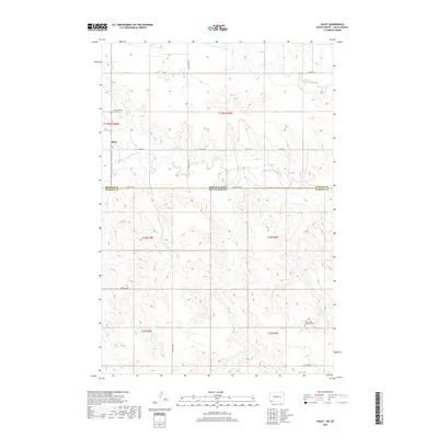
2018 Map of Haley
USGS Topo · Published 2018About this map
Haley sits just north of the state boundary where the High Plains of North Dakota meet South Dakota. This rural landscape is defined by the winding course of the North Fork Grand River, which carves through the undulating terrain alongside tributaries like Lewis Cr and Teeter Cr. The settlement patterns here are deeply rooted in the early 20th-century homesteading era, evidenced by the preservation of sites like the Haley Catholic Cemetery near the river and the Saint Johns Lutheran Cem further south.
Find a feature on this map
23 named features on this map. Tap any name to fly to it.
Don’t see what you’re looking for? This feature index may not catch every label — zoom into the map to look around manually.
Map Details
Editions of this 2018 Haley Map
This is the sole edition of this map. No revisions or reprints were ever made.
Other maps of this area

1935 · Reva
USGS Topo · 1:125,000

1953 · Dickinson
USGS Topo · 1:250,000

1954 · Lemmon
USGS Topo · 1:250,000

1957 · Dickinson
USGS Topo · 1:250,000

1957 · Lemmon
USGS Topo · 1:250,000

1968 · Ralph SW
USGS Topo · 1:24,000

1968 · Haley
USGS Topo · 1:24,000

1968 · Bowman-Haley Dam
USGS Topo · 1:24,000

1968 · Ralph
USGS Topo · 1:24,000

1969 · Gascoyne
USGS Topo · 1:24,000