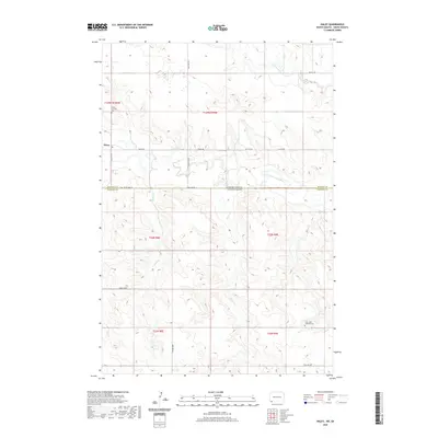
2020 Map of Haley
USGS Topo · Published 2020About this map
Haley sits near the winding course of the North Fork Grand River in this remote borderland between North Dakota and South Dakota. The landscape is defined by the drainage systems of Lightning Cr and several unnamed coulees that cut through the high plains. A small, concentrated settlement pattern is evident at Haley, while the surrounding sections are sparsely populated, tied together by a grid of rural routes such as 99th St SW and Twin Twp Rd. For genealogists, the Haley Catholic Cem serves as a significant landmark of the local community's heritage in the early 21st century. The topography reveals the characteristic plateau and valley structures of the northern plains, illustrating how the river valley provides a natural focal point for habitation in an otherwise open, arid environment.
Find a feature on this map
6 named features on this map. Tap any name to fly to it.
Don’t see what you’re looking for? This feature index may not catch every label — zoom into the map to look around manually.
Map Details
Editions of this 2020 Haley Map
This is the sole edition of this map. No revisions or reprints were ever made.
Other maps of this area

1935 · Reva
USGS Topo · 1:125,000

1953 · Dickinson
USGS Topo · 1:250,000

1954 · Lemmon
USGS Topo · 1:250,000

1957 · Dickinson
USGS Topo · 1:250,000

1957 · Lemmon
USGS Topo · 1:250,000

1968 · Ralph SW
USGS Topo · 1:24,000

1968 · Haley
USGS Topo · 1:24,000

1968 · Bowman-Haley Dam
USGS Topo · 1:24,000

1968 · Ralph
USGS Topo · 1:24,000

1969 · Gascoyne
USGS Topo · 1:24,000