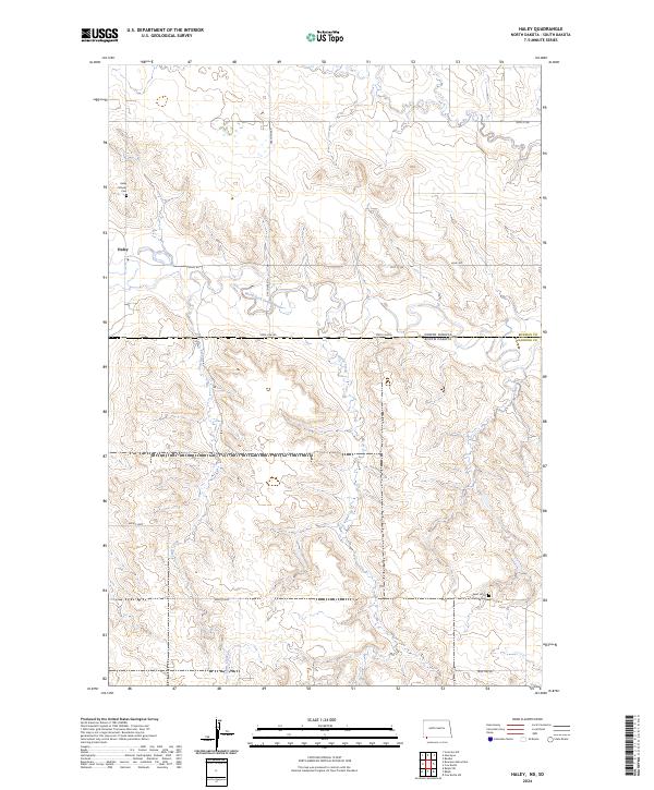
2024 Map of Haley
USGS Topo · Published 2024About this map
Haley sits at a geographic crossroads on the high plains of the North Dakota-South Dakota border, where the North Dakota South Dakota state line bisects the landscape. This area, largely defined by the drainage of the North Fork Grand River, shows a sparsely populated ranching or farming region where local history is anchored by sites like the Haley Catholic Cem and Saint Johns Lutheran Cem. The terrain is deeply etched by the meandering courses of Lewis Creek and Teeter Creek, which flow southward across the boundary between Bowman Co and Harding Co. A grid of rural routes such as Gascoyne Rd and Haley Rd provides access to these remote sections, while the distinctive Vessey Loop circles through the southwestern pastures.
Find a feature on this map
21 named features on this map. Tap any name to fly to it.
Don’t see what you’re looking for? This feature index may not catch every label — zoom into the map to look around manually.
Map Details
Editions of this 2024 Haley Map
This is the sole edition of this map. No revisions or reprints were ever made.
Other maps of this area

1935 · Reva
USGS Topo · 1:125,000

1953 · Dickinson
USGS Topo · 1:250,000

1954 · Lemmon
USGS Topo · 1:250,000

1957 · Dickinson
USGS Topo · 1:250,000

1957 · Lemmon
USGS Topo · 1:250,000

1968 · Ralph SW
USGS Topo · 1:24,000

1968 · Haley
USGS Topo · 1:24,000

1968 · Bowman-Haley Dam
USGS Topo · 1:24,000

1968 · Ralph
USGS Topo · 1:24,000

1969 · Gascoyne
USGS Topo · 1:24,000